 "Giant steps are what you take
Walking on the moon
I hope my legs don't break
Walking on the moon
We could walk forever
Walking on the moon"
Well known lyrics, from a well known song 'Walking on The Moon' by 'The Police" in 1979 - they and the tune were running through my head when we did this lovely walk across to the headland at Porth Kerry from Cold Knap near Barry Island back in November.
While I haven't actually been to the moon, the rock formations on this part of the South Wales, Glamorgan Heritage Coast are pretty amazing and for me anyway, have a 'lunar like' feel to them. Around the corner from the more commercialised seaside and industrial port setting of Barry, at low tide, on a sunny afternoon in November, Cold Knap provided a rather unexpectedly, tranquil, strange and beautiful setting to explore.
 |
| Th Knap Lido - Post card by Tuck DB cards |
Located on the Bristol Channel, this stretch of coastline has the second highest tidal range in the world, at about 15m. For this reason you should be careful about not getting cut off under the cliffs at high tide. Although the beach is pebble, at low tide a strip of sand is exposed. On a clear day there are good views across the Bristol Channel to the islands of Sully, Steep Holm and Flat Holm, and the Somerset coast, 15-20km beyond. This is a busy shipping channel with plenty of container ships to be seen heading up or downstream, or simply waiting for the tide to take them to the docks at Bristol, Newport, Cardiff, Barry or Sharpness.
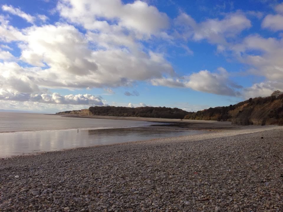 |
| Looking from the car park at The Knap towards the Porth Kerry headland |
As you move across the beach you begin to realise that the most amazing thing about this place is the rock formations.


The cliffs are made up of clearly visible, alternating layers of grey limestone and black shaley, mudstone and the limestone platforms on which you are standing have been cracked open and exposed by the action of the sea washing away the alluvial sediments where they were deposited onto the eroded carboniferous limestone surface. Here endeth the very interesting geology lesson (given to me by Jez who studied the subject as part of his degree)!


From the 'altar' continue walking across the pebbles towards the headland.


At the Western end you will reach Porth Kerry Beach, which lies at the bottom end of Porthkerry Country Park. A popular place for families and dog walkers, the area belonged to and was farmed by, the Romilly family from 1412, until it was sold to the local council in 1929 when it became a public park. The park and adjacent coastline is overlooked by an impressive railway viaduct, built in the 1890s to carry coal to Barry Docks. The viaduct is still in use. At this point you can hear, but not see, aircraft taking off from Cardiff Wales Airport which is just around the corner at Rhoose. Planes coming into land can be seen approaching from the South East over the Bristol Channel. From here we walked along the path at the edge of the country park until it met the pebble line, and then continued along to the headland, before retracing our steps back across 'the moon' to Cold Knap.

Looking back from the headland at Porth Kerry towards Cold Knapp, with Sully Island in the distance on the right

.jpg)


The Bristol Channel coastline can be very beautiful!


More information
Parking and public toilets are available alongside the beach at Cold Knap. There is a popular cafe and coffee shop in Cold Knap village.
The walk involves walking across large pebbles and rocks which can be difficult and it therefore demands strong footwear - walking boots recommended!
Be sure of tide times before attempting this walk Tide times
Dogs are not allowed on the beach May 1st - Sept 30th.
Reference Sources
Glamorgan and Gwent, A Guide to Ancient and Historic Wales - Elisabeth Whittle 1992
Weatherman Walking - BBC Wales
No comments:
Post a Comment