
 |
 |
 |
| Ariel view of St Cadoc's - by Coflein |
 From the way marked gate near the church, proceed straight ahead across the field until you reach the river bank and turn right under the railway bridge over a way-marked stile. From there you simply follow the course of the River Usk through a series of gates and stiles.
Dogs enjoy this walk for the swimming opportunities it provides, but be sure to keep them under close control and on a lead if necessary as there are usually sheep and cattle grazing.


The stunning vale of Usk

There are some beautiful trees and dramatic stumps on this walk!


Animal or human grave under a tree near one of the gateways? We weren't sure, but it has the inscription LL on it. It is most probably a dog or a horse. but whatever/whoever is buried here it makes a lovely, very picturesque final resting place. If you happen to know, do leave a comment below.

A lovely view of the Blorenge from here.

At the corner of one of the fields you will notice a World War 2 Pillbox. The remains of several brick Pillboxes, built in 1940, can be seen in various locations along the River Usk. They were part of a chain of defences set up to hinder German invasion. Inside soldiers armed with machine guns were placed, ready to open fire through the small window slits. It is thought that some of the pill boxes may now be used as roosting places for lesser horseshoe bats which is quite a nice thought, but we didn't see any in this one. As you can see I'm accompanied on most of my walks by a '10 year old'!!!!


The River Usk flowing through the meadows with the mountains as a backdrop is very beautiful, even on a grey day in November! Archdeacon William Coxe wrote about the beauty of this area in 1801 in his 'Historical Tour of Monmouthshire':
"rich meadows sink into an oval vale, interspersed by the meandering Usk and skirted by a range of gentle elevations, dotted with numerous seats, churches and hamlets; beyond these rise in grand succession, hills and mountains which combine the varieties of light and shade, and vie in the contrast and singularity of their forms. The extremity of the vale is closed by the Clytha hills, mantled with wood; the elegant and wooded swell of the Little Skyrrid is backed by the majestic top of St Michael's mount: the gloomy and irregular mass of the Black mountains bound the distant horizon; to these succeed the russett summits of the Gaer and Brynaro, the four Pen y Vale Hills which form beautiful undulations above the town of Abergavenny, and are crowned by the Sugar Loaf. Beyond the Sugar Loaf, the perspective of the Vale of Usk terminates in the rugged crags in the vicinity of Crickhowel; opposite towers the magnificent Blorenge, and joins the chain of hills which stretch to Pont y Pool. In no part of Monmouthshire are the forms of the mountains more beautifully contrasted"
So here are the mountains referred to by Coxe - below - left to right The Blorenge, with the crags of Pencerrig-calch and Table Mountain in the far distance at Crickhowell in the centre and The Sugar Loaf on the right. Out of shot further to the right is The Skirrid also known as St Michael's Mount or Holy Mountain. I'm sure all these peaks will feature somewhere, further along the line in posts of their own.

Fred Hando writes in 1951 that this area of the Usk Valley near Llanover, was in 1946, considered for the building of a giant coal powered, power station. What a good thing that thanks to strong local opposition, including from Hando himself, this was successfully averted - to destroy such a beautiful place would have been a travesty.

Dewi disturbed a buzzard feeding on a large, dead salmon on the rivers edge!


Continuing along the course of the river, eventually you will reach the bank opposite the boat house and St Bartholomew's Church at Llanover.


The small suspension bridge spanning the river here is privately owned and unfortunately there is no right of way over it. It is known as 'Mr Pym's Bridge' - the original bridge here was built for Leslie Pym local land agent for the Llanover and Llanarth Estates and Conservative MP for Monmouth 1939-1945. A descendant of leading Parliamentarian "King Pym" (John Pym) opposing King Charles 1 rule without parliament, Leslie Pym lived at nearby Penpergwm Lodge, which is now quite a renowned garden. He was father of Francis Pym, Foreign Secretary for Margaret Thatcher during The Falkland's War in 1982.
The Llanover estate, village and church on the other side of the bridge, has a lot of interesting history and deserves a blog post of its own, which I shall certainly do at a later point, but as you look across to St Bartholomew's Church it is interesting to think that buried there is 'Big Ben' - Sir Benjamin Hall MP who gave his name to the famous 'Big Ben' bell in Westminster.
 |
| Benjamin Hall |
 |
| Installation of 'Big Ben' in 1856 |
From here we retraced our steps back to St. Cadoc's Church.

Autumn leaves in the river with a promise of spring in the trees in the form of tightly formed catkins. In this shallow pool with the leaves on the edge of the river were tiny, juvenile fish which we thought might be salmon fry.

Molly is modelling a bark 'helmet' - a perfectly hollowed out piece of bark that we found on the river bank which I brought home to use in flower arranging!.

 |
.jpg)

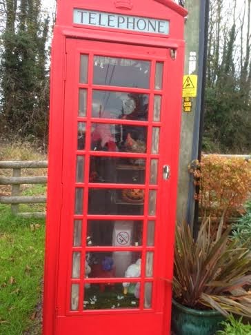 |
| The old telephone box at The Bryn decorated for Halloween!! |
This walk starts from St Cadoc's Church, Llangattock Juxta Usk near The Bryn, which is just off the B4598
Raglan - Abergavenny Road
Go past Penpergwm House and across the bridge over the A40.
Then follow the lane, bearing left and then right at the telephone box through the village until you reach the end of the lane. Take care it becomes very narrow.
Park on the roadside near Church Farm or in the Village Hall car park nearby.
Walk down the lane until you pass the church entrance on your right then go straight ahead to the gate and through into the field and follow the walk as above.
This is a relatively flat, easy, walk across closely grazed river meadows - there may be animals grazing so keep dogs under close control
St Cadoc's Church - Map of location
Map Reference: SO30NW Grid Reference: SO33020964
Reference Sources
Historical Tour Through Monmouthshire - Archdeacon William Coxe 1801 (1904 Edition)
 |
| Of course at the end of the walk there is usually coffee and cake! |
Journeys in Gwent - Fred J. Hando 1951
Exploring Gwent - Chris Barber 1984
The Gwent Village Book - Gwent Federation of Women's Institutes 1994
Llanover Country - Chris Barber 2004
Parliament UK - The Great Bell, Big Ben
Coflein - Royal Commission on The Ancient and Historical Buildings of Wales
Celtic Saints - Saint Cadoc
Madeleine Gray: The lives of St Cadoc and St Winifred - Wales Online 2011
Wikipaedia
No comments:
Post a Comment